Wednesday, November 10, 2021

Simple Things Create a Lot of Pleasure


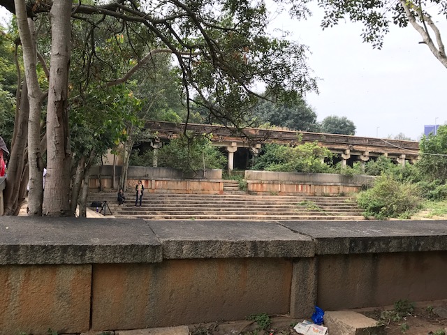
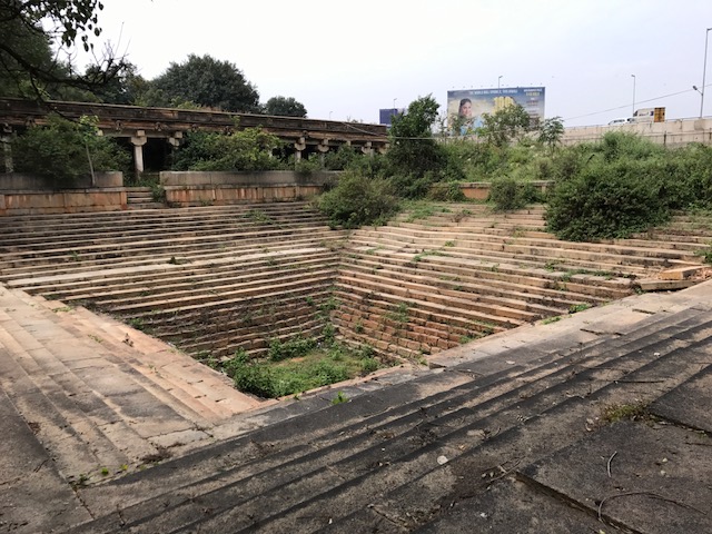
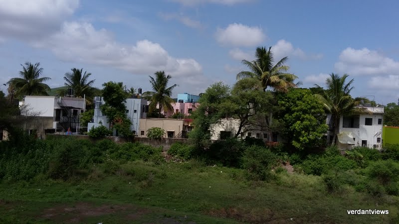
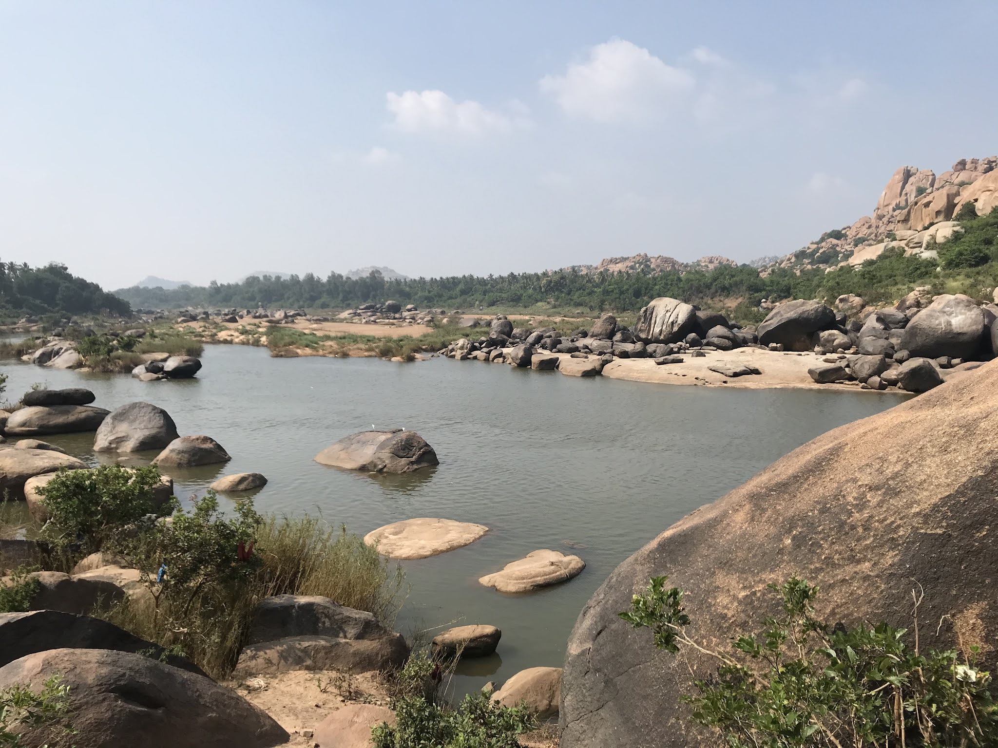
As I was travelling in an auto from the Hospet station towards my accommodation it hit me hard….the town was neat and clean; no trash along the roadside. An eyesore from viewing city trash in my daily travels, it was now wide open in surprise. A small canal from the Tungabhadra river with a few children running alongside was clean again! No bad smell, no trash in the canal.


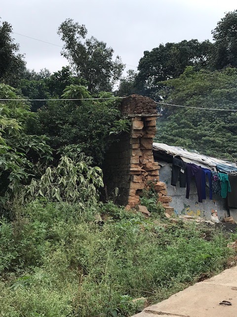
I derided myself – small town, easy to maintain; yet no one was obviously ‘maintaining’ it. Each household clears its front, deals with its trash and clearly, little or no need for any big maintenance plan. It was simple.


Can we maybe try that – not trash our own locality and in the long run we can also set an example.


Monday, December 2, 2019

The International Bazaar at Vijayanagar- Vijaya Vitthala Temple Complex


The Vijayanagar bazaar in the Krishnadevaraya’s times (around 1500 AD) was the second largest bazaar in the world, second only to the Egyptian bazaar, flaunted my local guide at the Vijaya Vitthala Temple, Hampi. While the veracity of this is moot what with the Egyptian highs related to the 3000-50 BC while Vijayanagar was centuries later, let’s not belittle his pride, for it is really becoming of the place!
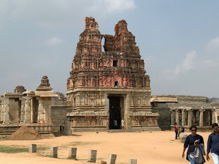
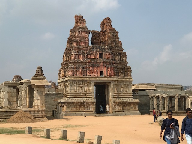
Entrance gopuram to Vijaya Vitthala Main Temple


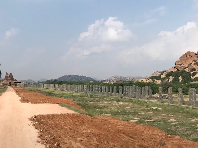
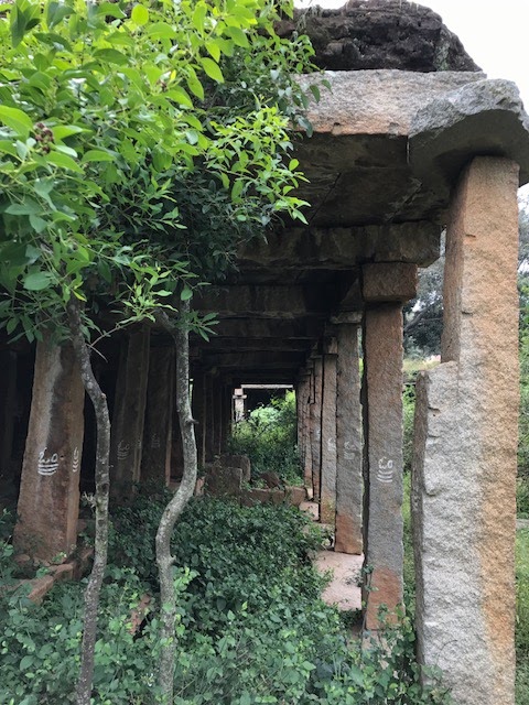
The pillars of the Hampi Bazaar leading up to the temple

The Vijaya Vitthala Complex, Hampi, and its famous bazaar whose operations are recorded meticulously in the inscriptions on the Temple and mantapas indicate an admirable cache of wealth, power, and yet the humility and largesse of its rulers. The ‘King’s Balance’ in the Vijaya Vitthala Complex where the king would weigh himself and give away the equivalent in gifts and rewards, is explicit of their famed benevolence.


The King's Balance- Hooks on top, and the inscription of the pious King and the Queens beneath it.

The large L-shaped pillared markets leading far out from the temple front exemplify the rich, thriving economy of those days. Their pride in success is evident as its activities are meticulously recorded on the wall carvings of the temple. Symbols of people of different ethnicities and countries bartering elephants, horses in exchange for jewels and riches in these markets, indicate a peaceful, multi-cultural society, known for its fame and was frequented by foreign travellers. “They are checking and counting the horse’s teeth before bartering it” pointed out my guide. He was an ASI-certified guide and his prowess further certified by my friendly and sporting local autowalla!


The Vijaya Vitthala temple complex is an exhaustive one, complete with all the facilities- public and royal baths, platforms for entertainment, markets for trade, resting and eating places, and places of worship and the main deity was Vitthala. The meaning of “Vitthala” as explained by singer Aruna Sairam when delivering a Marathi composition, stands for “Vitth” which is a brick and “Sthala” as in “a place or location”. It is said that when Krishna as Panduranga came to check in on the famed Pundalika for his loyalty and undivided service to his aged, invalid parents, Pundalika replied saying that he was busy and would come and meet him after he was done. Pundalika threw a brick and asked the guest to stand on it and wait. Thus, the name “Vitthala” to exemplify Krishna, a deity who commanded undivided faith and prayers.


The main parts to watch out for when you visit the complex include the Gejjala (Salangai or ghunghroo) Mantapa, Kaduregombe Mantapa, and a public bath opposite it. The Pushkarani or the royal bath with a mantapa for prayers, a long walkway with the famed bazaar on the right leading up to the main temple. A covered hall to the left of the main temple that is being meticulously restored for its fallen pillars, the main sanctum.


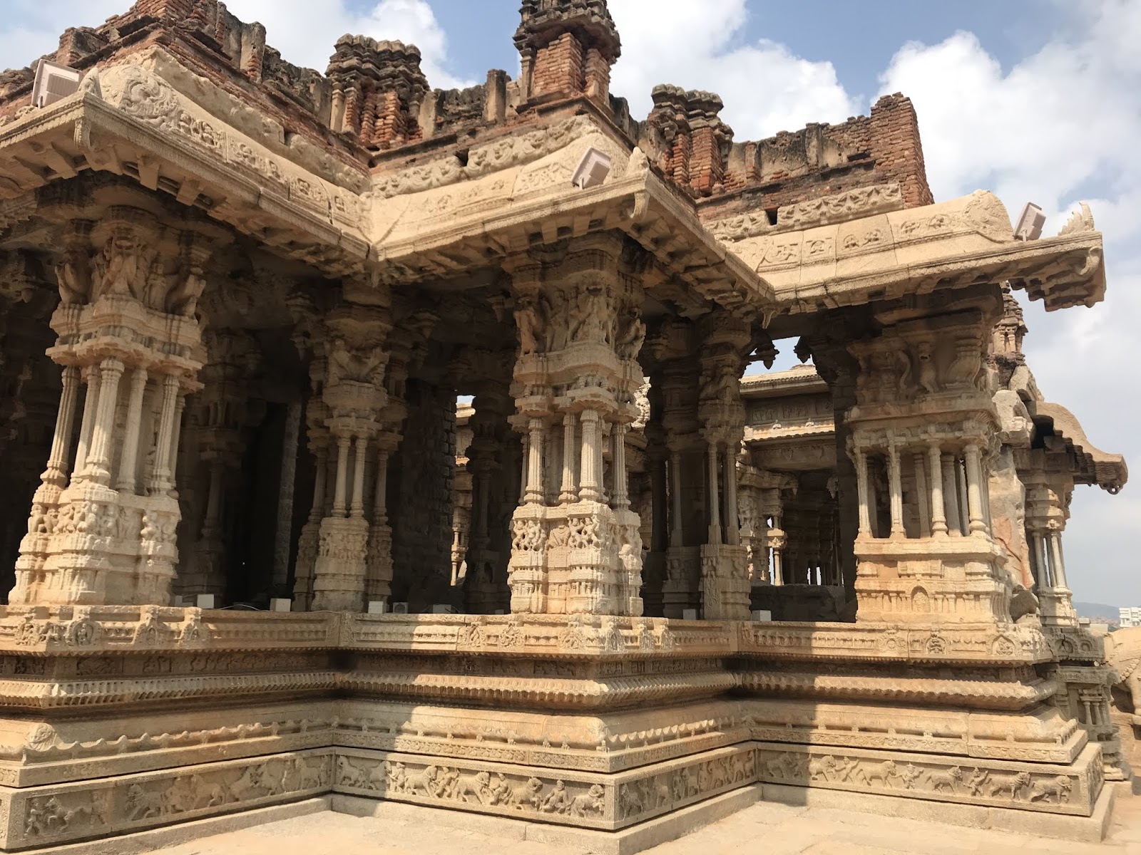
The main temple is itself large and intriguing, with the main gopuram (entrance structure atop the entryway), a Bhajana mantapa, a Tulsi mantapa, Deepa Sthambam and Homa kundam. The main idol of the sanctum is lost. The Musical Pillars is an engineering feat of those days that left me embarrassed of our flyovers with faults in the joints in sections and water dripping and scarring the road beneath it. The guide certifies that the pillars are not hollow; just the minute, carefully-engineered differences in their thicknesses and position of elements on the pillars that generate music, which can be heard afar when played.  

The Musical Pillars, Vijaya Vitthala Temple, Hampi


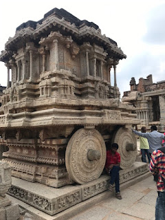
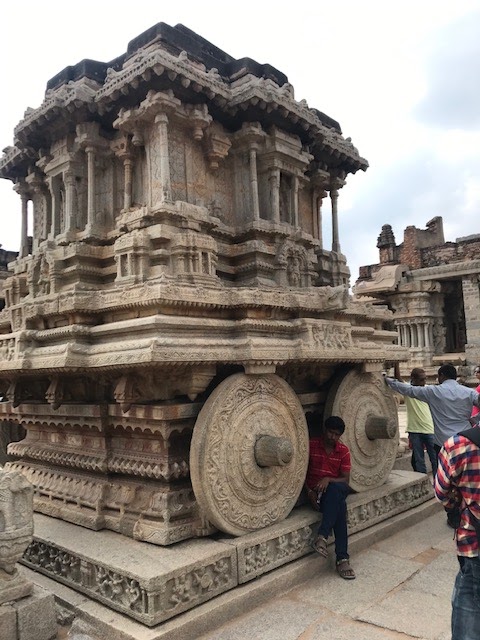
The Ratha
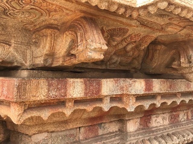
Remains of original colours on the Ratha
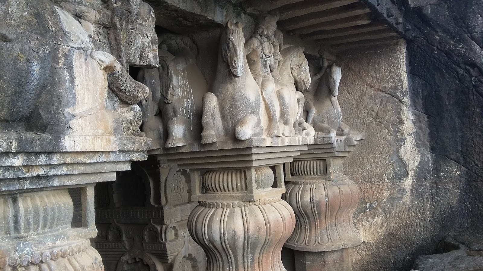
Back and out of the main temple, as you go clockwise around it, is the King’s Balance, a Vishnu temple behind with inscriptions in old Kannada, a gopuram over the exit to the right of the main sanctum, the famous stone chariot (a monolith Ratha), and a temple far-removed from the main temple and to your left as you complete the outer round of the main sanctum. This sanctum (Sannadhi) is curiously guarded by an Indian one side and a Mongol on the other side! It carries a rich cache of carvings of horse-drawn chariots, wars and such. The numbered bricks in this hall and the sanctum indicate a meticulous restoration. Intriguingly, the hall is outstanding for its angular approach pillars!


The entire complex is a long walk with items of interest all around. It’s best to walk up and around while going in and using the battery car service to drop you at the entrance on your way out. It’s best to hire a guide to point out the main structures and the details of the ratha, though they usually pepper it with their imagination! And a good 2-5 hours to see and relish the complex, depending upon the depth of your interest from a casual one to a sheer, mouth-aghast one leading you to devour the details in its entirety. I visited it a second time as I didn’t want to miss out anything!
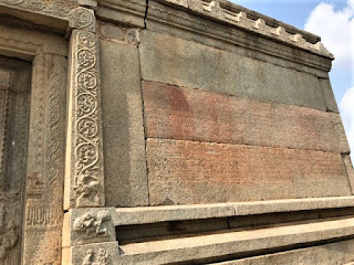

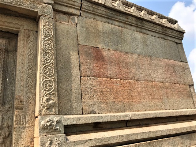
The Vishnu temple with inscriptions in old Kannada, Behind the main temple, Vijaya VItthala Complex 

There is an entrance fee for this complex that allows entry into the Kamalapur Archaeological Museum and the Zenana enclosure. The Museum leaves a lot of gaps in information for a museum enthusiast.

A local, well-informed auto guy and my buddy who effortlessly planned my itinerary for all the five days of my stay, if you are interested, is Ganesh 94820 53289.                                                                                                                                                                                                        


Thursday, November 21, 2019

Vested interests grab invaluable national heritage property in the erstwhile royal capital of the Vinayagar Dynasty - Anegundi, near Hampi

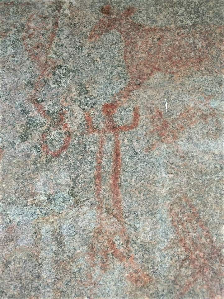
The priceless, though not a popularly visited site on a trip to Hampi is the Anegundi Cave
drawings. It is located at around 20 km from the Hampi bus stand by road which is
winding along the Tungabhadra river over the bridge and through verdant paddy and
sugarcane fields. The drawings have been studied and dated to 1500 BC and experts
have indicated a similarity to the Indus Valley Harappan drawings.

As old as the Egyptian paintings, it was clearly open to visits by informed travellers and
it carried an ASI Protected Monument board at the entrance, even up to three months
ago when my local conveyance guide had brought over tourists. Today, it left him and
me stumped and feeling helpless. The ASI board removed, a locked gate which had
read “Private Property” earlier was clearly masked with white paint indicating that the
person has been informed by the authorities or has realised that the place CANNOT be
private property. We spent over an hour calling out loudly, banging the door hoping to be
heard and allowed to approach the premises, to no avail. Back on the main road, we
attempted another approach as shown in Google maps, which indicated that both the
approaches were 200-250m from the point of interest. This was steeper and involved a
more dangerous climb onto larger rocks. A concerned local indicated that people from
the property would normally leave for lunch at around 1pm from the earlier entry gate and
suggested we go back and wait it out. We spent an hour, way over 1pm, hoping to spot
someone from inside and maybe get a chance to view the cave drawing.

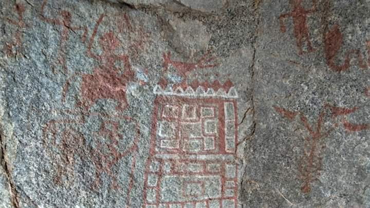
Anegundi cave carvings


Why should we have waited, why should we return disappointed from an obviously public,
protected property? Where were the authorities and did they know about this development,
were angry thoughts going through our minds as my guide dug around in his mobile and
showed me pictures of the cave drawings that he took in his last visit. He was definitely a
lot more disappointed that he couldn't take me there as he was clearly in awe of those


Anegundi Cave carving-similar to Harappan carvings

drawings and intelligent enough to realise how much it would matter to informed visitors.

In a spate of anger and disappointment, we informed the concerned authorities and hope
for immediate action against the perpetrator.


Friday, July 19, 2019

Buddhist Caves around Lonavla

Lonavla is ideally a hill station and popular in the rainy season with lovely views, fun trekking and lots of good local food. Well, that's what local hosts expect of tourists and frequenters from nearabouts to come there for.


I was a dapper for my simple, lovely-natured autowalla with whom I struck off on the first day outside the Lonavla station itself. Local, and familiar with all interesting things to do/see, and completely adept at predicting the daily vagaries of nature, as in, rains will become heavier/lighter, can we catch views or will clouds cover up the different peaks, and all such details that a visitor may get bogged with, I had it all laid out conveniently by this amazing man! I did get a few looks from him the first day, when at the end of a visit to the popular Karla Caves I told him the names of two other caves I wanted to go and kept bugging him on wanting to visit Shivaji's Lohgarh fort, which apparently is not frequently done in tour rounds and so the location may be desolated.


Well, I persisted on my requests in a nice way while respecting his local info, while he was adventurous and decided to check it out, after all, what with a nagging customer and it was a whole new revelation to both of us and a fantastic friendship was struck!

Karla caves and Ekvira Devi Temple

My autowalla dropped me off at the parking lot of the temple and the caves (located next to
each other) and told me its just a temple and a cave and it would take about 10 minutes. He
was completely bugged up when I landed there one and a half hours later...I was feeling
guilty too!

From where the road ends it is a good half an hour's climb up. Not tough to cover, a lot of
footfall and so climbing company too.


Ekvira Devi Temple is held is high faith by the local fishermen community, the Kolis of the area. On certain occasions, they walk from home in a procession singing and carrying items
of worship for the Devi and climb up to to the temple, often barefoot and irrespective of the weather. 

A local belief is that it was built by Pandavas during their exile when the Devi appeared before them and asked them to do so. Pleased with their faith and the temple

having been built overnight the Devi is believed to have granted them the boon that they

wouldn't be identified during their exile in the forest.

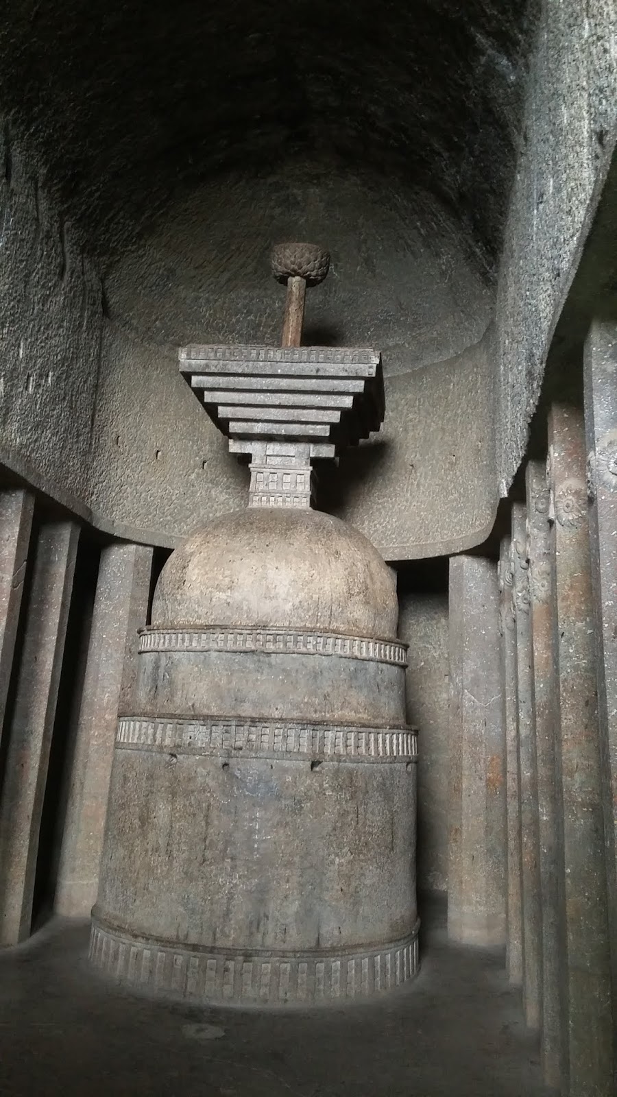
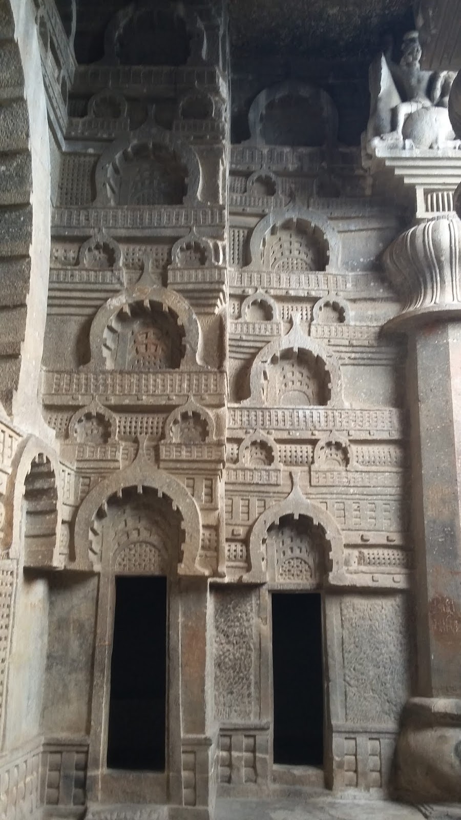
Karla caves estimated to have been made in the 2nd century BC is one of several such

caves that were built in those days for Buddhist who travelled all over and would often sit in

penance for over several years. Cave temple with rooms for stay and a dias for penance and stupas were cut out of rock faces, up in the mountains, away from local riffraff, protected from the rains so they the Buddhist yogis could peacefully pursue their life's purpose. 


The Hindu Theatre Fest, Bangalore 2018

It started on August 17, 2018, with a selection of three exclusive plays, the first of which was “Aurat, Aurat, Aurat" directed by Naseeruddin Shah. 

The place was abuzz with excitement, expectations high from the director and actors’ game, and with big names like The Hindu providing the platform.

Aurat, Aurat, Aurat: The play was on a very commonplace topic. One that’s been beaten black and blue across various mediums. Though still relevant after two odd generations of war against it, it’s still a little too mundane.

In the presentation of the subject, the story of Ismat Chughtai was good, though the dialogues were verbose. The brilliant acting added a little merriment and lightened up the otherwise beaten topic.  

Most importantly, it was predominantly an Urdu play, not one of the common Hindi spoken and oft-familiar language. So it is very likely that many in the audience would have missed the nuances of the story, that were presented is such a lovely jovial way by the actors.

The other two, much to the delight of all were lighter, and more easily enjoyable plays by women directors, with convenient subtitles cast high up on the stage backdrop which allowed for ease of watching the acting and occasionally catching up with the essence of the repartee. The language barrier was overcome, and so casually.  


Saturday, November 4, 2017

Hoysala King Vishnuvardhana's Chikkajala Fort, Bengaluru

A weekend morning, on free roads, it was a pleasure drive to reach Chikkajala Fort. I had spotted it six months ago when I drove in from the Bengaluru International Airport with my cargo, returning, sighing all the way, looking forward to the back-in-India triumph. After a long spell of seven years in Saudi Arabia, I definitely was noticing all such lovely spots to be discovered, seen, enjoyed and documented.


Main Parts of the Fort

The Temple Pond
The Chikkajala Fort built by Hoysala King Vishnuvardhana (1108-1152 AD) is lying in ruins along the new International Airport Road at Bengaluru. And the expansion and construction of the new freeway to the airport required a broader road, a portion of the fort wall was broken down for it.
Fort Wall Broken for Road Expansion

It was obviously falling apart, even in the first look, and I wanted to check it out at the earliest.

As you walk up to the fort, you see a Hanuman temple on your left and the temple pond in front of it. The back end of the semicircular fort wall still stands tall with small holes high up as a watch out, like in most forts. Large parts of the fort lie caved in, but the overall structure is still pretty clear as you dangerously walk through.


Water Storage Tanks Inside the Fort
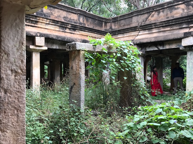
Dangerous, as with neglect over the centuries, large tree roots and branches have grown into the walls and many of the beautifully pillared corridors appear ready to cave in anytime. Several pillars looked solid though some were delicate, with their base exposed, and hence weak; others were just a loose assembly of stones (used in those days for construction) on the top, making the entire pillar look loose and ready to topple! It did cross my mind to keep my helmet on as I tried to parade through!

The parade through the fort corridors


Lovely Long Pillared Corridor
I was a bit wary of loose pillars but walked along what appears to be to two pillared lengths of an obviously rectangular area, with an open courtyard in the middle. Curiously, in the central open courtyard, there was an assembly of three stones. In my royal walk on the corridors, while I curiously tried to figure out the assembly, it was romance ruling the imagination! It did look like a setup to hang a swing, just wide enough to seat two!
Central open courtyard with a swing assembly

Its 22 km from the Hebbal flyover as you drive towards the airport. You need to drive past Yelahanka New Town. You will cross the fort and need to take a U-turn and drive back a short way. And the map was handy all the way, in the decision- off or onto the flyovers.     

Wednesday, June 1, 2016

Lohgarh Fort and Pawna Lake


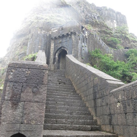
Strewn with blue patches of the myriad lakes and dams amidst mystic green mountains, the Pawna lake stands out of the lot. Similarly, of several forts built by Shivaji, Lohgarh fort is most easily reachable till the base by car and the climb made easier by later made steps, though these are also worn out in three places and ascent here needs some caution.

It was a challenging climb up the mount where Shivaji's Lohgarh fort was located but was real fun in the company of groups of college students from nearabouts. Catching up on the latest music and technology while facing mild passing showers of the seasonal rains, the hike up, though steep, was smoothened by the breathtaking sights at each level, and of course continuous clicking!
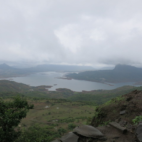
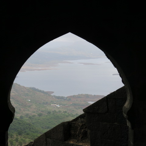
Pawna Lake View while climbing up to Lohgarh Fort

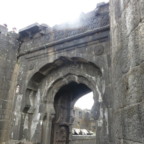
Lohgarh Fort and the Darwaza, as you climb

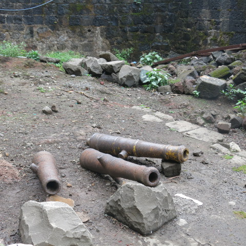
Closer to the top and along the steps a few remaining canons
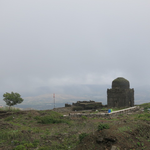
from those days have been set up for viewing, though with the climate of the region I would have preferred them to be carefully preserved in a museum. The fort at the top has a few interesting remnants of walls of those days, though the obvious sign of the Moghul override is clear in the prominent presence of the maqbara of an Ummr shiv, said a local elderly catching some breeze there.
Maqbara atop Shivaji's Lohgarh Fort


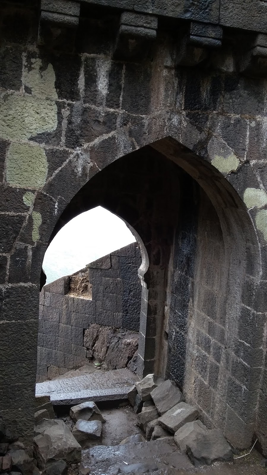
The interesting remnants include three main darwaza (or doors), entrances to the fort at various levels, two of which are the Ganesh darwaza and Hanuman darwaza. Several strategically placed holes in the fort walls allow for a clear view of the entire stretch of ground that approaches all sides of the fort.

Canons, Lohgarh Fort
Through most of the curves climbing up you can't miss this huge lake that once atop clearly spans and curls a good 270 degrees around this mount. Other lakes and Shivaji's Visapur forts are also visible in the distance.

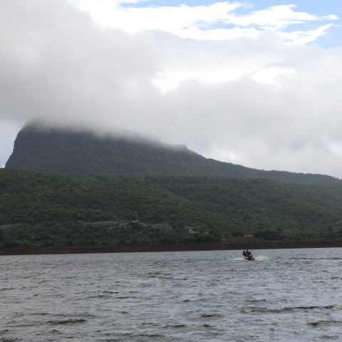
The Pawna lake is not just huge but it gets overwhelmingly fantastic as you climb down to the base of the mount. The sheer pleasure continues as you drive your way down from the base to the lake level. (Refer to 'how to get there'). The sun weaved it's way through the clouds while the mountains smoked away peacefully on one side. As the sun lowered I caught a patch of Pawna Lake water in an unbelievably bright, absolutely unrealistic, aquamarine blue while the peak behind it was sunny and the neighbouring peak was dulled by clouds. And no! I rechecked, I didn't have my sunglasses on then!


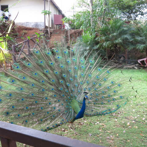
Sighing and wishing to genie-it-into-a-bottle, a speed boat ride at Pawna lake and a peacock dance display at the private dock that runs the service, was an experience topping my holiday!


Good to know:
  • Days of intermittent rains and before the rainy season sets in, the local auto/ taxi walas are the best judge of when and which peaks will be open for views. So don't go by the hotel list of tourist spots, as most of them are peaks!

  • Boating is provided by MTDC at and by this one other private entity at Pawna Lake, as I pleasantly discovered. MTDC is hmm..well a government body, and so off and on, so call in the day before you go. The private provider at Pawna lake is definitely good, but Pawna Lake is deep and the waves become very high during rains and heavy winds, so you need to plan the trip for the sunny/light drizzle part of the day.

  • Many hotels have the word "resort" attached to their names, though they are just hotels! So if you're looking for fun family time at a resort, don't go by the name or fancy pictures on online booking sites.
How to get there:
  • On the old Mumbai-Pune highway, as you drive away from Lonavala/ Mumbai, at a 20 minutes' distance, crossing the Wax museum, Kinara Dhaba you meet a crossroad where you can see an archway on your left that says "Ekvira Devi temple". Take the right turn there and proceed to Pawna. If you're a history buff, you can catch the "Bhaja caves" Buddhist caves from 2nd BC, though it has a climb and you need to plan a good 2 hours for this location also in your day. This route leads you to the end of the Pawna Lake with the boating deck.

  • The alternate way is to keep driving on the old Mumbai-Pune highway up to "Khamset", which takes about 25-30 minutes and you get a crossroad where you will a non-imposing building labelled "Khamset hospital" on your left, you take a right there, asking your way to "Bhedse" village, a good 14kms' drive on sections of bad roads, ghats, where you will see boards for Pawna Lake. Incidentally, on this route is yet another set of Buddhist caves called Bhedse caves. It's a smaller ascent up to these caves and takes lesser time than the Bhaja and the Karla caves. But this is less known and not frequented by tourists, so you may have to go it up alone. Nothing to fear at all if you're moderately fit and are carrying some drinking water. Very doable safely on your own.

Wednesday, February 10, 2016

Khidr- Interesting learnings about Aya Sofia, Istanbul


Reading about Islam, the concept of Khidr, an immortal spirit that can travel great distances and manifest in different forms; one that’s been identified as the servant of God in the Quran and linked to a companion of Moses was a revelation to me!

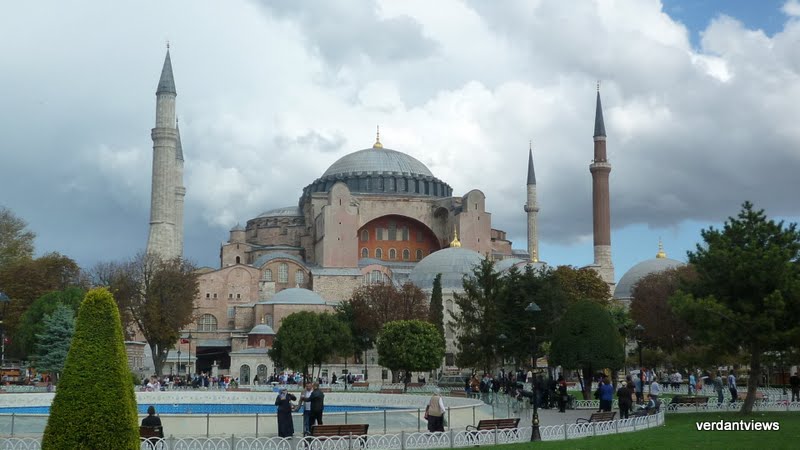
Firstly, I was intrigued that it's similar to the Hindu concept of one central immortal spirit and secondly, that it is deeply woven into Christian and Islamic psyche too; deep enough to influence the construction and decor of the monumental Aya Sofia and other important structures with such unwavering faith and devotion.

All those who have already done a trip to Turkey, please find a reason to go back at least to Istanbul to reexamine this spirit at work! It was an absolutely stunning read about the developments, so I am going back!

When Constantinople (present-day Istanbul) was run over by Ottomans (Muslim Turks) In 1453, the sultan then, Mehmet II established Istanbul as the capital, moving away from Edirne and was faced with the task of rebuilding the church of Aya Sofia built by the Byzantine (Roman) rulers. As per the account of Mehmet II’s biographer, Ottoman writers studied the earlier manuscripts to figure out about the construction and the aura around Aya Sofia. They then wrote their accounts in which Muslim martyrs, heroes were mentioned. But in all the reads and writes about the awe of Aya Sofia, the central figure of the enigmatic Khidr was given pride of place, in the choice of location and the final form.

The biographer of the first Ottoman ruler, Mehmet II, writes that the Khidr had urged Justinian, the Byzantine emperor to build the church at this site, slated to be the site of an ancient temple to show the victory of Christianity (the Romans) over paganism (indigenous polytheistic practices of the place run over). And that the plan of this great church was revealed to Khidr and handed over to the architect.

The special majestic qualities and sacred status of Aya Sofia made it very difficult to transform it into a church and a later date into a mosque. Both Romans and Ottomans believed Aya Sofia to be divinely inspired. This inspired some of the mosaics in certain key places inside the church. The doorway in the south-west vestibule which was used for processions during Byzantine rule has an important mosaic of the Virgin and Child with Justinian and Constantine. Constantine holds a model of the city of Constantinople while Justinian offers a miniature Aya Sofia to the Mother of God. Yet another inspired mosaic showing innate respect to the higher power in the construction of Aya Sofia is located above the central door leading to the main nave which shows an unnamed emperor bowing to an enthroned Christ.

This architectural triumph of Aya Sofia was built over an older religious construction that was built here after the Nika riots of 532 AD. It was a symbol of a double victory of Christianity and the Byzantine empire.

And yes, its not just Babri Masjid that we need to be fighting and killing each other over. Most holy places that were run over by another tribe/ clan of different faith, each of them definitely felt the need to redefine the older religious structure and make it relevant to their faith. This, so that the reestablishment of the now new faith is made easier, and transformation from the earlier faith becomes easier for people who have long been worshipping at the place, either reluctantly or by force now. Climb upto the fort at Lonavala and find a makbara on top is just one of such example. But let me emphasize this- whatever the faith of the victor, deep down faith, respect and an innate fear of God ensures that the central sanctum sanctorum was never disturbed. That was considered to unleash the wrath of God.


Sunday, September 13, 2015

The non metropolitan break


Not intended to put off the reader or with any deliberate intention to sound bombastic, the above title is a rare experience in the lives of any resident of metros who's fallen the trap of the daily rigour.

Reads: A break for the mind is the best break. Oh! That was exactly my thought!

As my train leaves the Chennai metro and rushes out up and westwards from spanning the entire width of the Deccan and chugging its way up and around the eastern and western ghats to Lonavala, I am surprised afresh even after doing the length for over 8 years in the past.
Greeen! So green. No Camera could capture
that verdant a green- nature's flourish!

The myriad of old heritage, and new swanky and untidy constructions are left behind and the eyes and the heart are elated at the sights of dispersed, low rise, a handful of houses interspersed with large expanses of greens. Abetted with a few passing showers from a few days before, it is a simple, earthy delight to see the dull, cloudy skies with a cool breeze and to actually be able to see crops swaying in the winds. A rare sight along any of my regular routes to work, play, gym or recreation-movies and malls!


I feel so small and uninformed when I wonder at the occupation, education, entertainment options of folks whose houses and towns rush past. I learn that the national electric grid is owned, run and maintained by the Central Government from a short distance traveller in my coach. I use multiple electronic devices, work in highly overcooled offices pushing for an ISO certification, always use air-conditioned vehicles to navigate the city, curse when power
cuts happen due to rains, winds and lightning, and swear at electricity officials who don't turn up to set it right. Yet the same rains in vast verdant fields lightens my heart and I feel small for not knowing where all the power I consume comes from or who works hard to provide that to me.

Well, it was time a fantastic time to learn basic, oft-ignored basic information from new folks I met while soaking in the freshness of the greens.


Sunday, March 29, 2015

Hail Tourism


A small, pleasant town, sleeping in on their last day of fasting on the occasion of Ramadan and looking forward to Eid celebrations late night and inch back to the regular schedule of eating, sleeping and working was really heartening to see.


A landmark roundabout in Hail town

As a tourist this quaint town attracted me in the convenience it accords, with all major supermarkets, local date and vegetable markets, simple souls and traditional handicrafts available within the main area of the town centre. Typical old town areas congested in the evening with shoppers and families looking for an evening out.

But as a tourist and having informed myself of the multitudes of treasures of history at the location and my excitement built up knowing that these are treasures from more than 9500 years ago, the simplicity, quaintness of folks was very inconvenient.

A long 250 km drive from Hail city up to a much publicised volcanic site- Harrat ithnayn ( about 140km SW of Hail) was a complete confusion with no indication, directions, or any boards with the location marked. It was just a huge expanse of volcanic material on the ground. What was appalling was after enquiring with many or almost any soul on the road, everyone is jinxed, completely unaware of such a site! It was not just the language, having to converse in Arabic; I had an Arabic English conversant person on board. The local people had no information, awareness, knowledge, that apparently stems from no immediate need or inquisitiveness to know about these national treasures. The appalling apathy was shocking for someone like me who has seen the pride and possessiveness of locals in historical locations worldwide, be it Egypt, Africa, Finland, USA, Europe or South-East Asian countries.


Vast volcanic ash expanse

Understandably, the SCTA has a huge task ahead in protecting, researching, documenting, creating awareness among locals in the area and advertising/publicising them to encourage touristic curiosity in locals as expats in the region. Meanwhile a good move would be to involve, inform, train local people in the areas of historical finds, to understand and take pride in them, which would be a good start. History buffs like me, and several expats living in Saudi could help volunteer with government departments, and experts working to collate and publicize such discoveries.


My voluntary services are available to KSA tourism department for use! Thanks!

Sunday, February 8, 2015

Trip from the First (Al Awwal) street to the Edge of the World in a day!

An apprehensive morning's start, armed with a lot of food and water considering it was a Friday and most stores would be off the first half, ended a really rewarded one. The trip to the "Edge of the World" or "Aakhiri Duniya" as it is referred to by folks near the place, was a little scary....we'd already tried it in our Accord 3 years ago, knew we needed a 4-wheel drive to beat the sandy patches, and were aware of presence of local mujahideen who were pointed by our jeep driver the last time, though he never did take us to the right place then! As simpler, easier-to-please persons those days, we had nice picnic fun that day and got back home happy and warmed up in the wintry sunshine.

A lot of better information, a trial trip on the main road the previous weekend and exchange with locals in the area later, we set out bravely yesterday on our trip, in finding the edge of the world. Amusingly as a friend noted, the first main road we set out on was the "Al Awwal" or "The first" (technically, Prince Turki bin Abdulaziz Al Awwal Road) street of Riyadh, and were somewhat apprehensively wondering if we'd make it to the right location- The Edge of the World, this time round. It was a welcome humour to the mild trepidation of the morning- the first to the last!

As the wheels lowered off the main road, one could feel a carful of doubt at the uncertainty ahead. Beaten and thumped around on bumpy patches and sensing the rear wheels zipping uncontrollably in sandy patches, we covered the entire distance in half an hour though it seemed like it took forever to reach! Faster, more experienced drivers-of-the-sands had reached there, so we could find out final spot to rest the car and stretch out jilted bones! A nice breakfast of hot idlis, sambhar and tea prepping ourselves for walking the rough terrain, we set out with our cameras, water and sugary treats in case it gets too tiring on the way back.


At each stage of the climb or walk the next leg looked dangerously narrow and close to the edge until you got there and assured yourself that it's actually not so bad. We must have climbed up and legged a good 3-4 km rightwards after reaching the top. Each stop was astonishing and views absolutely so happiness-satiating, one would feel so close to nature and the impossibility of nature's creation! Clearly, years of rains, water and wind activity had cut out semi-circular ranges of mountains with water basins between them. Each ridge of all the mountain faces intricately carved out looking like as though artists hung and decorated them! Reminded me of stories of how Michael Angelo hung off the roof and painted the domes, walls and niches of the Sistine Chapel. Only, here it was sheer, deep faces of entire mountain ranges spanning as-far-as-eyes-could-see kind of distances intricately carved out over the centuries by nature!


Setting out from home at 7am, it was 10 am when we took off the main road into the sands towards the Edge of the World, and finally piqued, exhilarated and exhausted with almost-broken-bones, we climbed back onto the main road at 3pm, washed at the petrol pump and picnicked at a local farm, caught a short leg-stretched-out nap and headed back to main town Riyadh reaching at 6pm.


Directions: Arouba road, onto King Khaled Road 535 N, get off at the Jubayla junction and 30 kms from there, even before the Sadus town, where you see some pipelines being laid and a sandy incline built upto the ridge on your right, get off onto the sand, drive a good 7 kms to reach the rangers tent, take the car into their borders and then drive a rough patch for a good 22kms keeping largely to the right at all doubtful forks. Leaving early morning is advisable to be able to deal with any uncertainties, car troubles and managing to leave the rangers premises before 6pm when they close the entrance. And yes, a ton of water, a lot of food, and emptying out our system systematically before leaving and after reaching the main, paved highways of Riyadh. Needless to say, there are no washrooms in the entire 30 kms stretch of unpaved road on the approach to the Edge of the World, and you have the challenge of several hours of climbing up and down, and walking narrow patches of mountainsides involved.

Happy, soul-filling views!